Tacloban City (Tacloban City)
 |
Tacloban City was briefly the capital of the Philippines under the Commonwealth Government, from October 20, 1944, to February 27, 1945. In an extensive survey conducted by the Asian Institute of Management Policy Center and released in July 2010, Tacloban City ranks as the fifth most competitive city in the Philippines, and second in the emerging cities category. On November 8, 2013, the city was largely destroyed by Typhoon Haiyan, having previously suffered similar destruction and loss of life in 1897 and 1912. On January 17, 2015, Pope Francis visited Tacloban during his Papal Visit to the Philippines and held a mass at Barangay San Jose, and later he led mass of 30,000 people in front of the airport.
Tacloban was first known as Kankabatok, an allusion to the first inhabitants – Kabatok. They established their dwellings in the vicinity of the present day Santo Niño Church. Others who came later were Gumoda, Haraging and Huraw who erected their own settlements in nearby sites. Huraw 's domain is the hill where the city hall now sits. The combined settlements acquired the name Kankabatok, meaning "property of Kabatok's".
The constant threat of pirates due to its lack of a natural barrier hindered the development and progress of the settlement. And so the place never figured out in the early centuries of the Spanish colonization of Leyte. When the Jesuits (the first evangelizers of Leyte) left in 1768, the Augustinians took over and in 1770 they established the barrio with a chapel (visita) of Tacloban under the jurisdiction of Palo.
The Augustinians who came from the Province of the Holy Name of Jesus based in Cebu were also responsible in introducing the devotion to the Santo Niño becoming therefore the heavenly patron of the settlement. With the Moro raids in check, the place became a hub for commercial activity and soon after the place was renamed Tacloban becoming an independent municipality and then capital of the province of Leyte. In 1843, the Augustinians ceded the administration of the parish to the Franciscans.
The change of the name came about in this manner: Kankabatok was a favorite haunt of fishermen. They would use a bamboo contraption called a "taklub" to catch crabs, shrimps or fish. When asked where they were going, the fishermen would answer, "(to) tarakluban", which meant the place where they used the device to catch these marine resources. Eventually, the name Tarakluban or Tacloban took prominence.
It is not known when Tacloban became a municipality because records supporting this fact were destroyed during a typhoon. It is commonly believed that Tacloban was officially proclaimed a municipality in 1770s. In 1768, Leyte and Samar were separated into two provinces, each constituting a politico-military province. Due to its strategic location, Tacloban became a vital trading point between the two provinces.
The capital of Leyte was transferred from one town to another with Tacloban as the last on February 26, 1830. The decision to make Tacloban the capital was based on the following reasons: 1) ideal location of the port and 2) well-sheltered and adequate facilities. On June 20, 1952, Tacloban was proclaimed a chartered city by virtue of Republic Act No. 760.
The arrival of Colonel Arthur Murray in 1901 made him the first military governor of Leyte. His first official act was the opening of Tacloban port to world commerce. Before World War II, Tacloban was the commercial, education, social and cultural center of the Province of Leyte. Copra and abaca were exported in large quantities. The leading institutions were: Leyte Normal School, Leyte High School, Leyte Trade School, Holy Infant Academy and Tacloban Catholic Institute.
In November 1912, a typhoon swept through the central Philippines and "practically destroyed" Tacloban. In Tacloban and Capiz on the island of Panay, the death toll was 15,000, half the population of those cities at the time.
Map - Tacloban City (Tacloban City)
Map
Country - Philippines
 |
 |
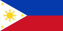
| Flag of the Philippines | |
Negritos, some of the archipelago's earliest inhabitants, were followed by successive waves of Austronesian peoples. Adoption of animism, Hinduism and Islam established island-kingdoms called Kedatuan, Rajahnates, and Sultanates. The arrival of Ferdinand Magellan, a Portuguese explorer leading a fleet for Spain, marked the beginning of Spanish colonization. In 1543, Spanish explorer Ruy López de Villalobos named the archipelago Las Islas Filipinas in honor of Philip II of Spain. Spanish settlement through Mexico, beginning in 1565, led to the Philippines becoming ruled by the Spanish Empire for more than 300 years. During this time, Catholicism became the dominant religion, and Manila became the western hub of trans-Pacific trade. In 1896, the Philippine Revolution began, which then became entwined with the 1898 Spanish–American War. Spain ceded the territory to the United States, while Filipino revolutionaries declared the First Philippine Republic. The ensuing Philippine–American War ended with the United States establishing control over the territory, which they maintained until the Japanese invasion of the islands during World War II. Following liberation, the Philippines became independent in 1946. Since then, the unitary sovereign state has often had a tumultuous experience with democracy, which included the overthrow of a decades-long dictatorship by a nonviolent revolution.
Currency / Language
| ISO | Currency | Symbol | Significant figures |
|---|---|---|---|
| PHP | Philippine peso | ₱ | 2 |
| ISO | Language |
|---|---|
| EN | English language |
| TL | Tagalog language |


